Suffolk, England

Members Login
Username 
 
Password 
    Remember Me  
Post Info
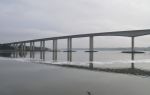
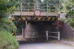
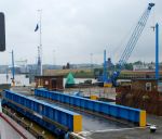
TOPIC: Water Crossings, Bridges, Fords etc


Administrator

Posts: 34113
Date:
Water Crossings, Bridges, Fords etc


We are well blessed with lots of bridges and fords some are still in evidence others not so, some are ancient some are not, why not tell us about your particular crossing old or new in your village/hamlet or town.

I recall that from Bridge Wood to near where The River Orwell Bridge is situated on the Wherstead Bank there used to be a Roman Crossing that could be used at low tide, this was made up of stone and shale, I must admit I haven't seen any evidence of this since the river was dredged many years ago to allow larger shipping to visit the Port of Ipswich at any state of the tide.

Another important Roman Crossing was at Stratford St Mary across the Stour and another at Cattawade.

The best preserved Packhorse Bridge in Suffolk is over The River Kennet at Moulton, the oldest bridge in use by road traffic is The Toppesfield Bridge at Hadleigh/Lower Layham.

Without some bridges some communities would be cut off, Southwold for example and the North part of the River Waveney separating North Lowestoft from South Lowestoft, Can you imagine the detour if Oulton and Lowestoft had no bridges!   

__________________


Administrator

Posts: 34113
Date:

I can think of the following Ferries that are used on River Crossings in Suffolk The Butley Ferry Harwich, Shotley, to Felixstowe [Foot Ferry] Havergate Island [RSPB Ferry] Orfordness Ferry [was once a Z Ferry LST to ferry cars, equipment and people to the peninsular] for National Trust Members and workers on the BBC World Service Station Transmitters Walberswick to Southwold Foot Ferry 


__________________


Administrator

Posts: 34113
Date:

Orwell Bridge

Orwell BridgeDSC_0119.JPG


Attachments
__________________


Administrator

Posts: 34113
Date:

This railway bridge near Bosmere Mill, Needham Market has caused many problems over the years with vans and trucks, as you can see the height is no more than 8' and since the introduction of Satellite Navigation systems the situation has been exasperated, much publicity was given to this problem quite recently

Suff Needham Rly Bridge 189.JPG


Attachments
__________________


Administrator

Posts: 34113
Date:


The Bridge that once went over the Wet dock in Ipswich, now preserved

Swing bridge wetdock Ipswich railway line fDSC_0942.JPG


Attachments
__________________
1 2 322  >  Last»  | Page of 22  sorted by
Quick Reply

Please log in to post quick replies.


Create your own FREE Forum
Report Abuse
Powered by ActiveBoard